La Campana National Park
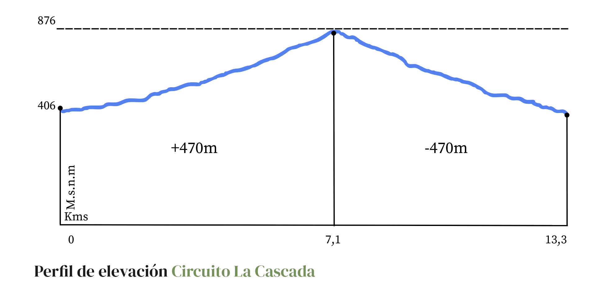
Waterfall Circuit
13.3km 6hr 39min470mt
Difficulty: Medium
A medium difficulty day hike through ravines and hills, towards the spectacular waterfall La Cortadera, 25 meters high, and the viewpoints of its surroundings, with views of the mountain range that faces the National Park in the Ocoa sector and the contrasts between the plant formations that populate its hillsides.
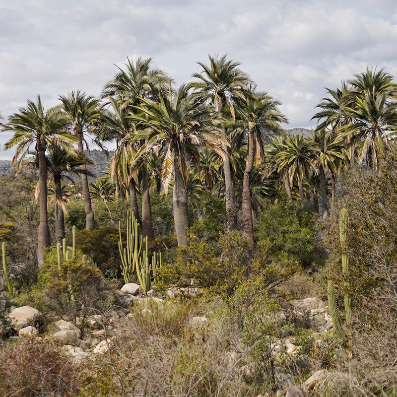
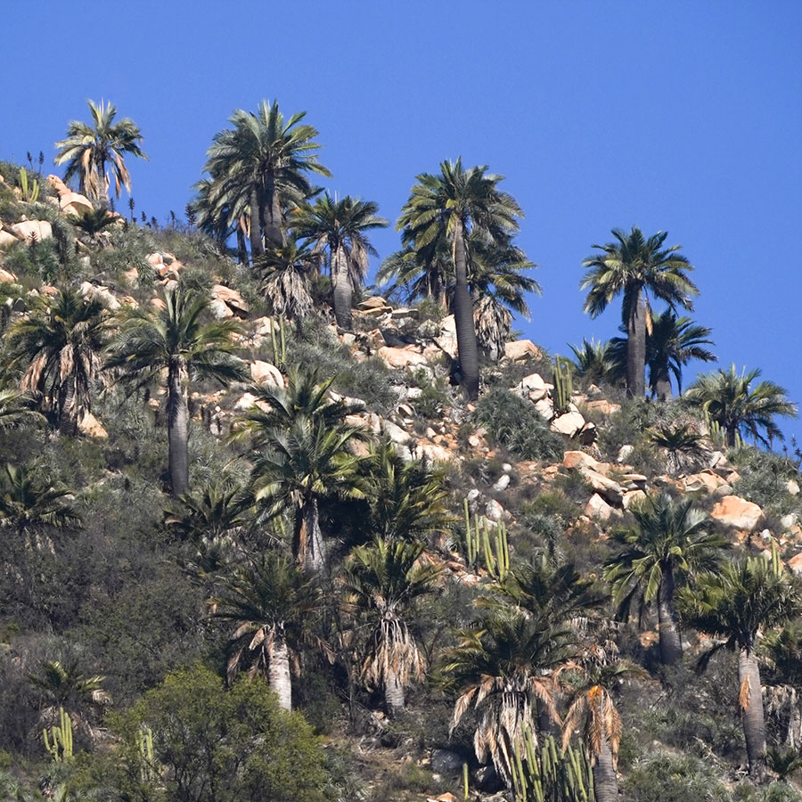
The route goes through El Cuarzo Creek, which collects water from the peaks of El Roble and Punta Imán, the highest mountains in the national park, alternating between sclerophyllous forest and thorny scrub, with abundant presence of Chilean palms, rocky outcrops and large stone massifs.
It is recommended to visit after the first rain of autumn until October, to avoid intense heat and exposure to the sun
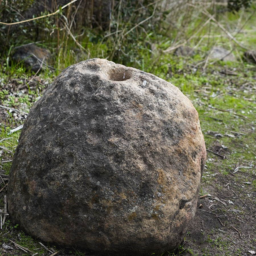
1. Cup Stone
The cup stones found in the Aconcagua Valley in Chile are archaeological remains of human groups that lived in the region between 150 BC and 700 AD. These stones, known as cup stones, are often found near water sources and were likely used for grinding food or natural medicines. The fact that all the stones have similar holes suggests a cultural guideline on how to drill them. It is important to protect these stones from damage, such as graffiti or displacement, as they provide valuable insights into the ways of life of past inhabitants and help us understand the local culture.
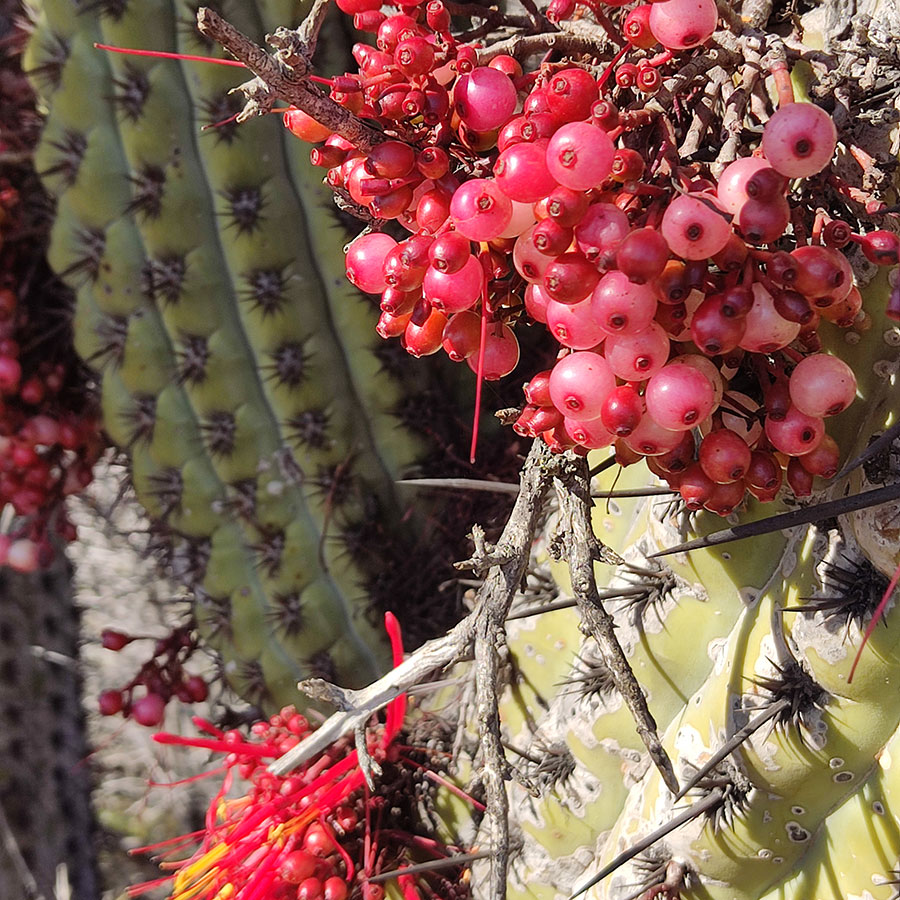
2. Chilean Mockingbird and Quintral seed
The Chilean Mockingbird (Mimus tenca) is a bird native to Chile and Argentina, which has a wide geographical distribution in our country since it is possible to find it from Copiapó in the north to Frutillar in the south. Its habitat is usually open forests, that is, not very leafy, and areas of shrubs and bushes. It usually lays its eggs in the spring and summer months, in nests that look like cups formed by fine plant fibers and are very hidden in tree branches.
The Chilean Mockingbird is very famous for its ability to imitate the song of other birds of central Chile such as the Diuca and the Thrush. It is a completely omnivorous bird as it has been observed feeding on insects, lizards and fruits. Among its favorite fruits is the fruit of the Quintral.
The Quintral is a shrub of the Tristerix genus and grows on different trees and plants of the sclerophyllous forest. It is a hemiparasite because although it feeds on the parasitized plant, it is also capable of photosynthesis with its own leaves. The Quintral del Quisco (Tristerix aphyllus) is one of the most common in the park and with its fruit, a berry similar to a grape, attracts visitors such as the tench that when feeding on it, defecates the seed ready to germinate elsewhere.
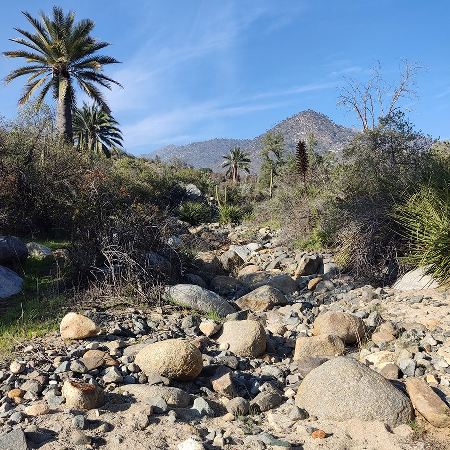
3. Stream and bridge (fluvial sediments)
In this sector you can appreciate the force that the tributaries have had to move material from the slopes of the hills to the ground where you are standing. The hydraulic transport has been able to drag the rocks from the highest parts of the ravines, filling the valley with rocks or clasts of different sizes that, by showing rounded shapes, show the wear they have suffered as a result of the rough journey from their origin.
The main sub-basins that have played a leading role in the conformation of the soil in which you find yourself are Quebrada El Amasijo and Quebrada El Cuarzo, which are characterized by permanent water streams that run all year round. Both streams are fed by other intermittent streams that emerge during periods of heavy rainfall or when snow that accumulates on the park's peaks during the winter melts.
In years when rainfall is torrential, phenomena such as alluvium can occur, which means that the force of the water will be able to detach the rocky material and drag it over longer distances, which in combination with the dragged mud can cause sediment accumulation.
4. Collecting ravine
A collector ravine corresponds to a runoff that receives tributaries from an entire basin, allowing its drainage by means of a river. Depending on the time of year when you visit this spot, the creek may appear completely dry or manifest itself in the form of an estuary of crystalline waters due to rainfall. Either way, the mark that this collector creek has left on the landscape is undeniable. It is possible to observe the trace of the water, which has dragged rocks, deposited along its bed and then, over the years, modeled them with the rounded shapes that you can see.
But you are not the only person who has been absorbed by the beauty of the composition of this landscape. At the end of the 19th century, Onofre Jarpa, a Chilean landscape painter, captured his impression of the scenic beauty of the ravine in his beautiful painting called "Palmas de Ocoa", which is currently housed in the National Museum of Fine Arts. In this work you can see the portrait of the bed of rocks irrigated by the crystalline water, immersed in the wonderful vegetation and the palms that have been preserved to this day.
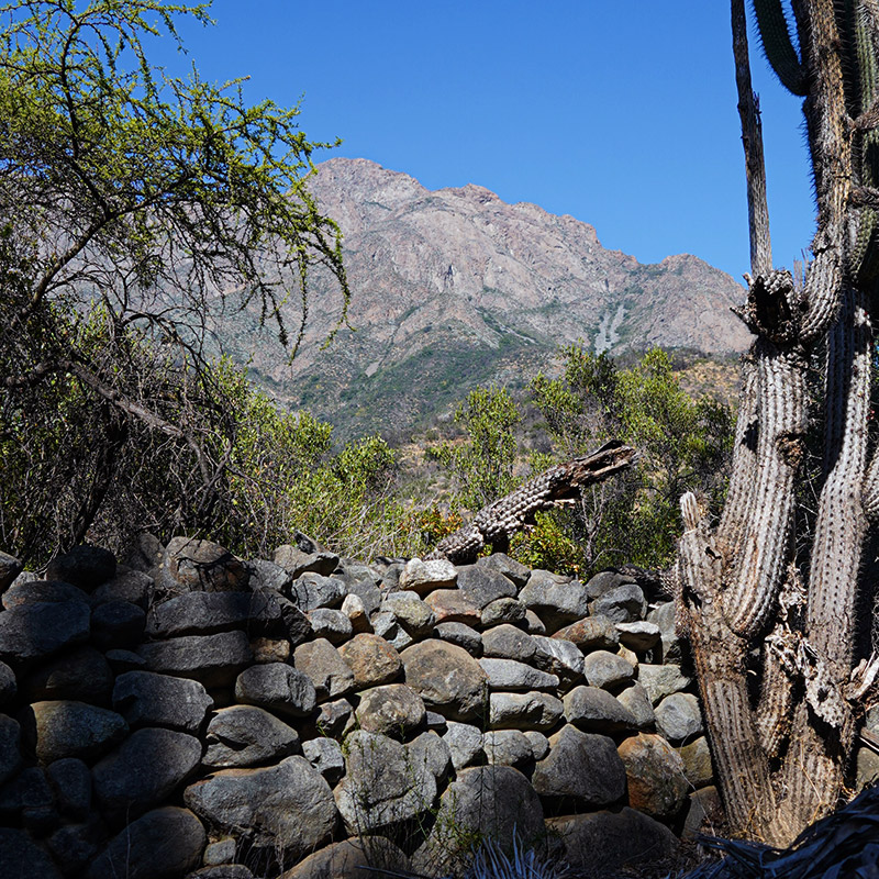
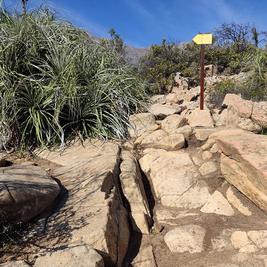
5. Pirca
Until its creation, La Campana National Park was a place where diverse economic and traditional activities were carried out, many of them associated with the development of large-scale haciendas such as the Olmué Hacienda or the Mariana de Osorio Community, which originated in colonial times. The main activities that were carried out were related to agricultural production and livestock raising, whose vestiges can still be seen today, including dams, portezuelos and pircas. These structures have great cultural value because they are a historical record of the rural lifestyle in the sector. In addition, they have an emotional value for the generations of herders who have continued the development of these traditional activities. The pircas are low walls built by stacking unhewn rocks and have traditionally been used to divide properties.
6. Boulders
When you look up to the tops of the hills in front of you, you can see the rocky material peeking through the vegetation. As you can see, there are rounded large rocks located next to each other. This heterogeneous conformation of the terrain is called boulder chaos or granite chaos, and sometimes achieves the appearance of a slope with steps. The chaos of boulders corresponds to a geomorphological phenomenon in which the rocks are being eroded, losing material in a spheroidal way as if it were an onion losing layers. This occurs because the mineral composition of the rocks is dominated by granite, a mineral composed mainly of quartz and potassium feldspar.
The erosion of these rocks is occurring on site, by elements such as rainfall or abrupt changes in temperature, but it is possible that some blocks may break off and move to lower sectors of the slope due to the effect of gravity. In addition, you will be able to observe under your feet a sort of "sand" that corresponds to the fine particles of the meteorized material of the blocks that can be seen up there and that have been brought up here by the washing carried out by the rains.
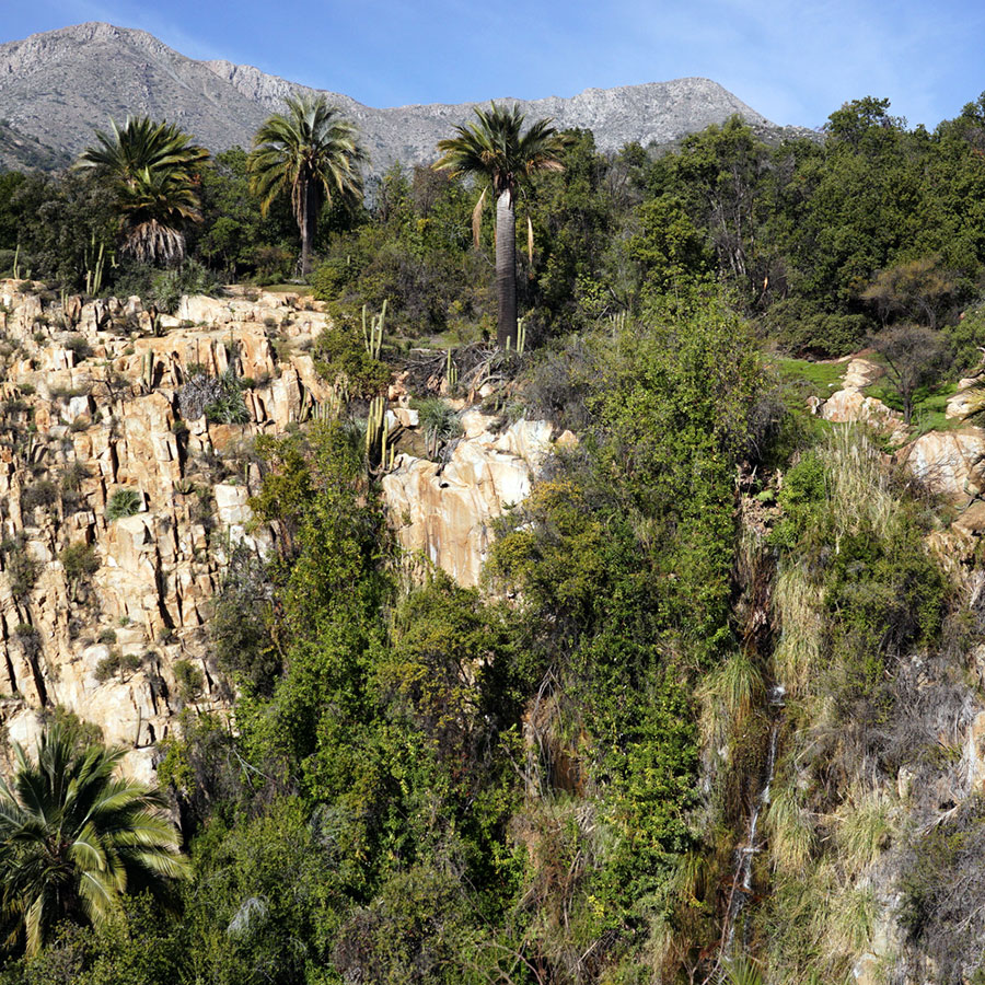
7. Bridge (Biomas)
A biome is an area that is distinguished by the particular environment, vegetation and fauna that coexist there. This observation point is very special from this perspective because you can appreciate, in one place, the coexistence of the three biomes present in La Campana National Park: the deciduous and sclerophyllous forest and the low altitude scrub.
While standing on the bridge you can observe that near the water course there are tree species such as the Maqui (Aristotelia chilensis), the Maquicillo (Azara petiolaris), the Michay (Berberis actinacantha), and myrtaceae such as the Arrayán macho (Raphithamnus spinosus) or the Chequén (Luma chequen). These species correspond to the biome of the deciduous forest, with leafy treetops and a high water requirement.
Looking around you, you will notice that far from the water course there are tree species with harder leaves such as the Litre (Lithraea caustica) and the Quillay (Quillaja saponaria), which represent the sclerophyllous forest biome better adapted to sunshine and water scarcity.
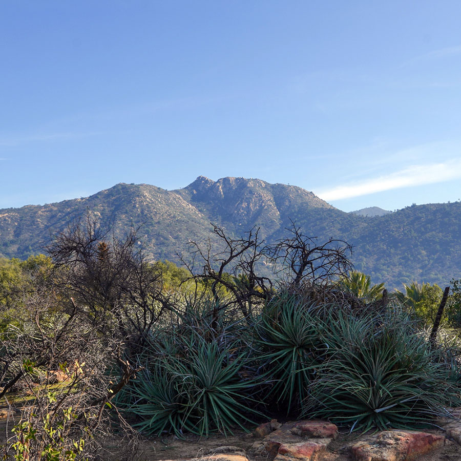
But if you move a little further away from the water course, you can observe tall cacti and succulents like the Quisco (Echinopsis chiloensis) or the Chagual (Puya chilensis), in coexistence with shrubs like the Tevo (Trevoa trinervis) and even grasses like the Chuquiraga (Chuquiraga oppositifolia). These species represent the low altitude shrubland biome, adapted to the oscillating conditions between the high daily sunshine and low night temperatures of the rocky peaks of the coastal mountain range of central Chile.
8. Fractured Rock
The rocks here have very peculiar shapes. As you can see, many of them look like they have been cut into large puzzle pieces. What you see is evidence of the conditions the rocks have had to endure outdoors. Weathering is the process by which rocks are altered and disintegrated by various factors that affect them as they come to the surface. Physical weathering, which is one of the most clearly observed in this landscape, corresponds to the disintegration of the rock by forces that, although they alter its shape, do not alter the composition of its minerals. Abrupt temperature changes are one of the forces capable of doing this modeling work by fracturing the rock into pieces in a process called thermoclasticity. In this process, the heat received by the rock from the sun's rays during the day causes it to expand, while at nightfall temperatures drop abruptly, causing it to contract and break.
9. Waterfall
La Campana National Park is home to a great lithological wealth. The relief has been shaped by a combination of elements such as the folding of the earth's cortex as a result of plate tectonics, the emergence of large-scale fractures or faults, and the outcropping of different types of minerals. These elements have caused the coexistence of lithostratigraphic units, also called geological formations, of different dates. Among them are the Lo Prado Formation, the La Horqueta Formation, the plutón de Caleu, the La Campana unit and the Dioritic unit.
From the viewpoint of the waterfall you can not only appreciate how the faults in the terrain have caused the outcropping of minerals arranged in columns, giving rise to a massive wall, but you can also observe the modeling work carried out by the water. Surface water is capable of eroding the terrain as it passes through, weathering its bed by transporting sediments that it carries from the headwaters, the place where it originates. However, when the rocky material is very resistant to erosion, the water course will take much longer to achieve its modeling, as in the case of La Cortadera waterfall, a waterfall that extends for more than 25 meters.
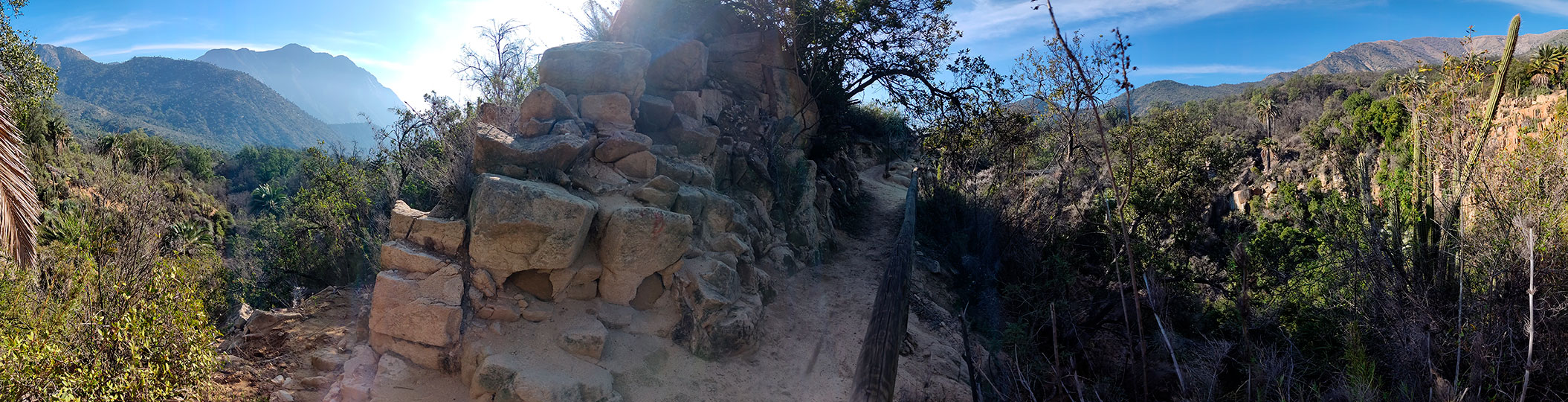
10. Landscape analysis
This viewpoint will allow you to observe the natural systems that make up the landscape composition of La Campana National Park. From here you can observe a panoramic view of the topographic features of the landscape and the way in which the processes of slope dynamics, such as gravity and rain, have softened the foothills. You can also observe how the mountain range in which you are located right now extends across the Ocoa Valley.
You can also appreciate the vegetation that covers almost the entire observable surface. You can notice some differences between what exists on one hillside and what exists on the other. In addition, you will notice that the darker colors of vegetation outline the more humid zones, allowing you to make out in the distance those sectors that correspond to ravines or streams.
Arrastrar
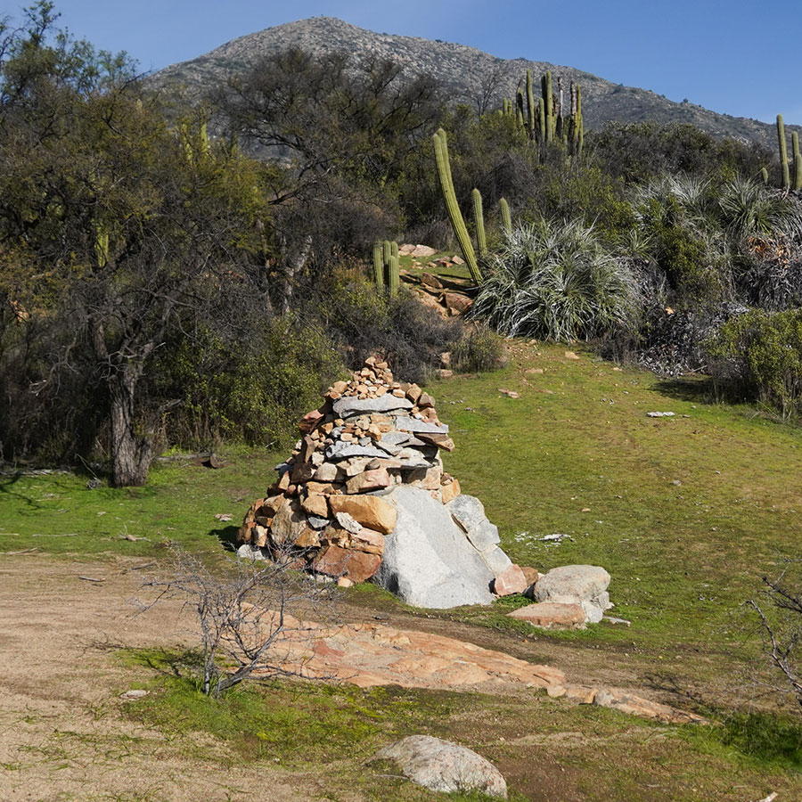
11. Apacheta
What was the culture like in the first half of the millennium that ended in the year 2000?
They domesticated plants and camelids. Guanaco meat and bones were used as tools. Low valleys, suitable for the development of agriculture. Red and orange pottery. Cemeteries near the houses. Its domestic use is discussed as food milling or ritual, linked to ceremonies or water cults.
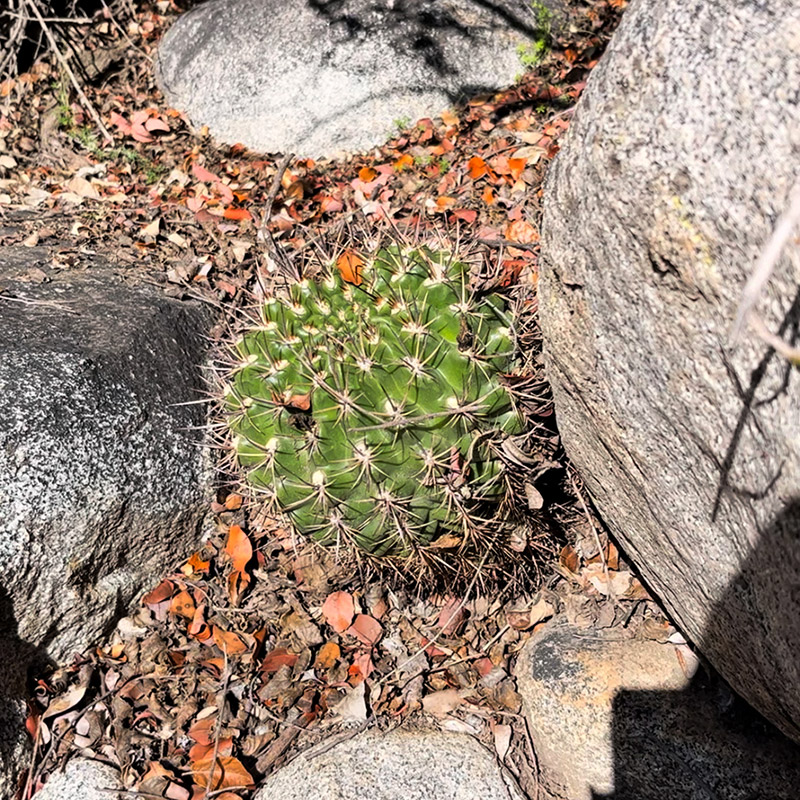
12. Quisquito de Ocoa and lichens
In this place you can observe, on one hand, the Quisquito de Ocoa or Eriosyce curvispina, a cactus of spherical bushy growth, with rigid spines of dark brown and black colors. This cactus inhabits rocky sectors of the hills of central Chile, growing among rocks. Its large funnel-shaped flowers are reddish to yellowish in color, then turn into oval fruits that produce the seeds of the cactus. The Quisquito de Ocoa usually coexists with other species of the sclerophyllous scrub.
On the other hand, if you look around you can also notice that there are rocks "stained" with lichens. As we have seen in other stops on the Ocoa Routes, lichens are living beings that arise from the symbiotic association between a fungus and an algae. In La Campana National Park you can observe them inhabiting diverse environments giving colorful tones to the bark of the trees, the soil and the surface of the rocks. The color is a characteristic that will depend on the species of lichen you are observing, as they can be greenish, yellowish, orange and even blue-green. Some species can resist dry conditions for long periods of time as is the case of these rock lichens around you.
13. Detrital flow
The landscape of La Campana National Park is in constant activity, since geomorphological processes are occurring everywhere and at all times. As you can see if you look towards El Roble hill, you can observe some material flows descending from the highest parts. The debris is the result of the disintegration of the rocks on the slopes of the hillsides due to factors such as rainfall, snow melt or temperature oscillation during the day. Debris flows are a process of removal and transport of this detached rocky material, due to gravity or rainfall. When the flow loses speed, it settles at the bottom of ravines, drawing these elongated spots at the top of the slopes. How many debris flows can you see from the point where you are now?