Books

Landscape analysis

La Campana National Park, in the Ocoa region, offers a diverse and captivating landscape. From its imposing peaks and mountains, such as Cerro La Campana, which rises majestically above the horizon, to its lush native forests, home to a variety of flora and fauna. The extensive trails allow you to explore its sclerophyll forests, cross rivers and canyons, and discover the geological and archaeological wonders that decorate this national park.

Cerro La Campana

El Palmar Circuit - Item N°2

"Mining activity in the Andes is millenary, perhaps as old as man on our continent. The extraction of salt and borates from the salt flats, the exploitation of clay banks for the manufacture of ceramic vessels, the extraction of volcanic glass and basalts for the manufacture of projectile points or other cutting tools, the collection of sediments of different shades for use as pigments, the location of quartz veins and semi precious rocks for the elaboration of ornaments, the outcrops of granitic rock with which they made hammers, mills or sculptures, the use of mud for bricks and plaster, and the list goes on with many varieties of elements of volcanic, metamorphic and sedimentary origin that were used for different purposes since immemorial times".

Christian Vitry, Mountaineer and Anthropologist

“The story goes back to the time of La Conquista (Conquest of Chile), when the Spaniards recently arrived in the Limache Valley heard from the local natives that in ancient times the cone of La Campana was a rock glittering with gold and gems, coveted by a foreign and courageous nation, that came to conquer it, but that the machis, or sorcerers of the place, resolved to outwit the greed of the strangers, arranging that in one night a thick layer of granite would fall on the enchanted hill, which would hide its coveted treasures forever”.

Andrés González Valencia

Mountain Ranges

El Palmar Circuit - Item N°3

Look at this landscape with a wide perspective. A panoramic view that almost completely covers the Ocoa sector of La Campana National Park.

To our right, the Cerro La Campana stands out, with its 1,828 meters above sea level. From there, following the line of peaks to the left, we descend until we reach a lower point. There is the portezuelo de Ocoa, where the trail that joins this sector of the park with those of Cajón Grande and Granizo passes.

Then the line ascends and is interrupted by El Labrado hill, which is on a closer plane, dividing the waters of the El Amasijo (right) and Cuarzo (left) streams. To its left, Punta Imán (right), 2,035 meters above sea level, and El Roble hill (left), 2,222 meters above sea level, mark the Park's border with the Caleu community and the Metropolitan Region.

And further to the left, the nearest line of hills, with El Litre hill at 1,621 meters above sea level, marks the closure of the National Park to the north, with its third collector ravine, La Buitrera, at the bottom.

Drag

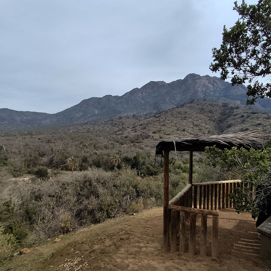
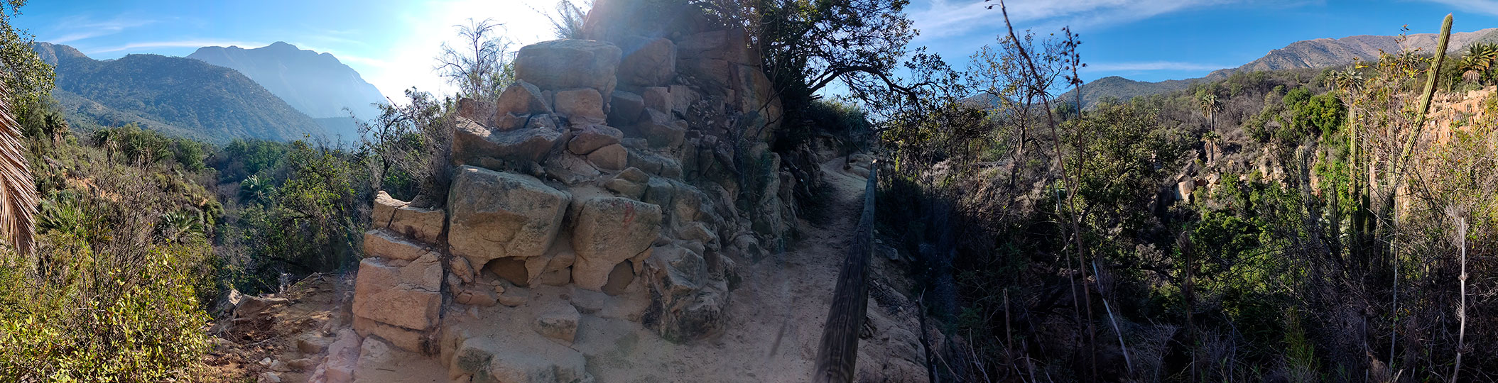
Viewpoint to the Amasijo

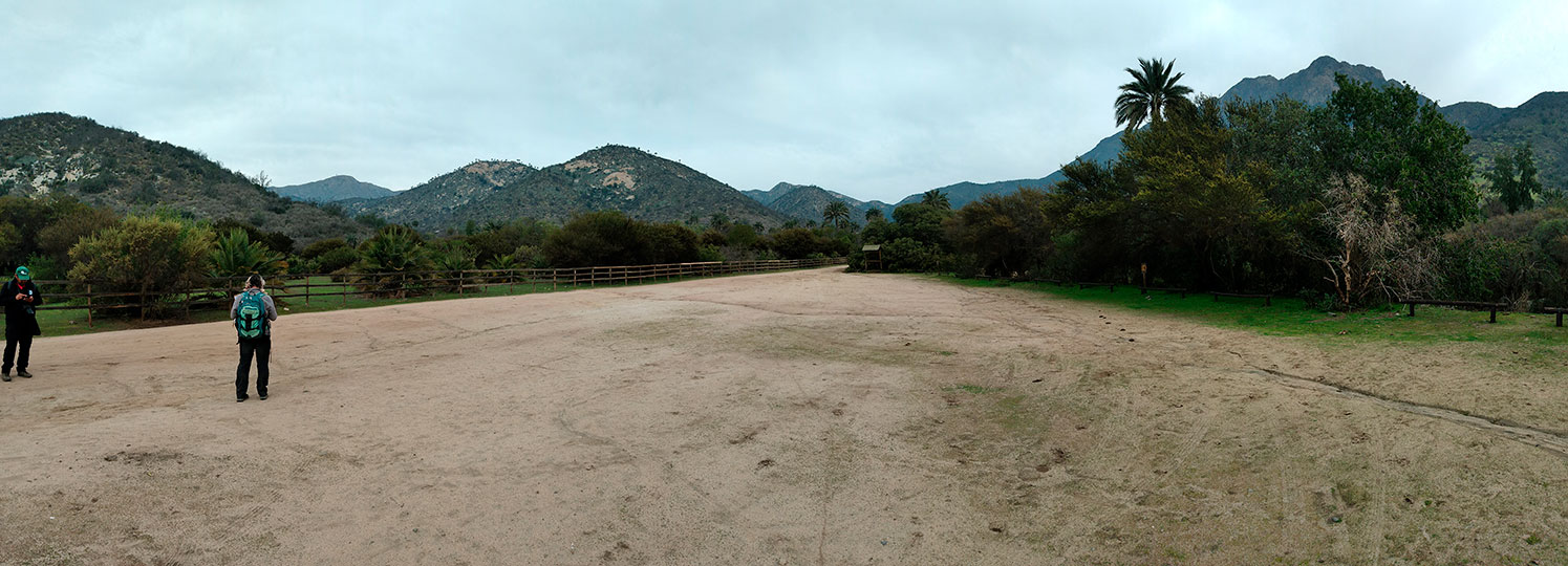
El Palmar Circuit - Item N°11

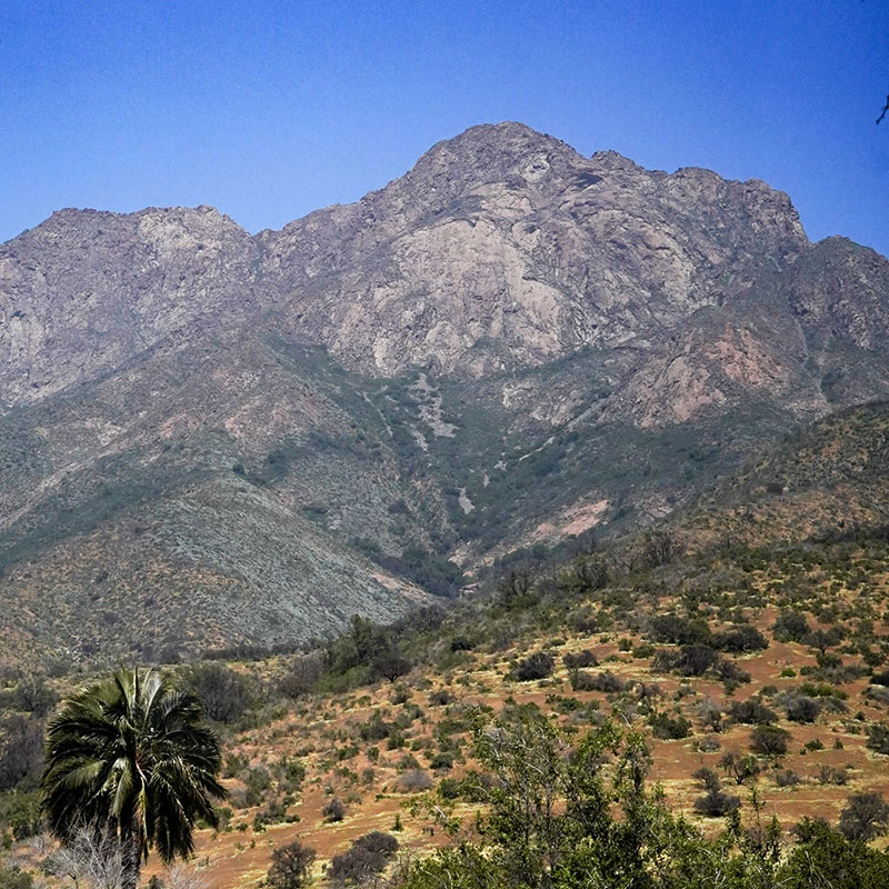
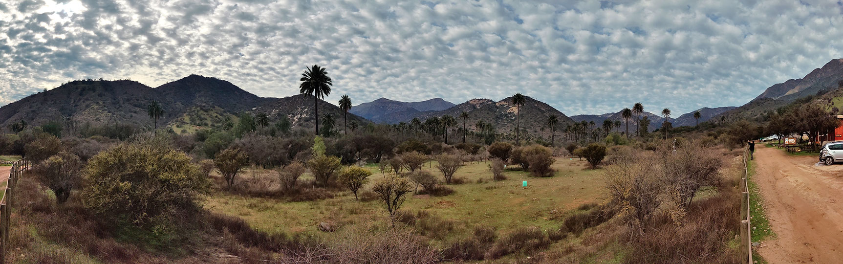
La Campana National Park is located in the Coastal Mountain Range, immediately south of the Aconcagua River, whose transverse valley is the last of its kind, before the formation of the central valley and the intermediate depression to the south. It has a total surface area of 8,000 hectares and is divided into three sectors: Ocoa, with 5,440 hectares; Granizo, with 972 hectares; and Cajón Grande, with 1,588 hectares.

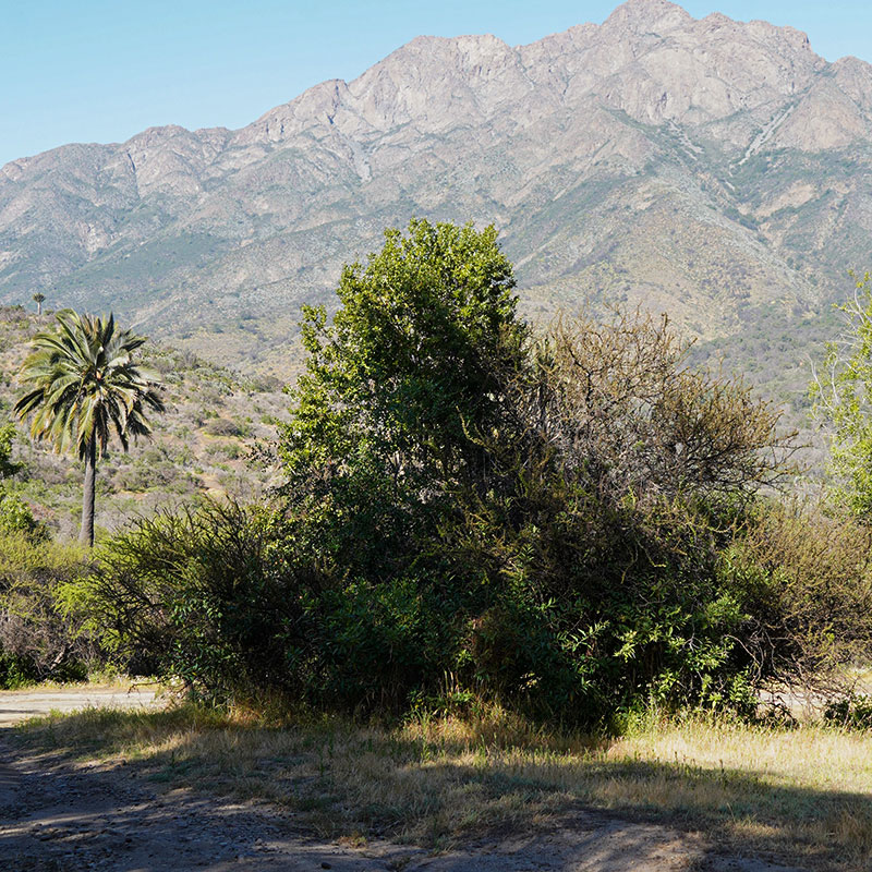
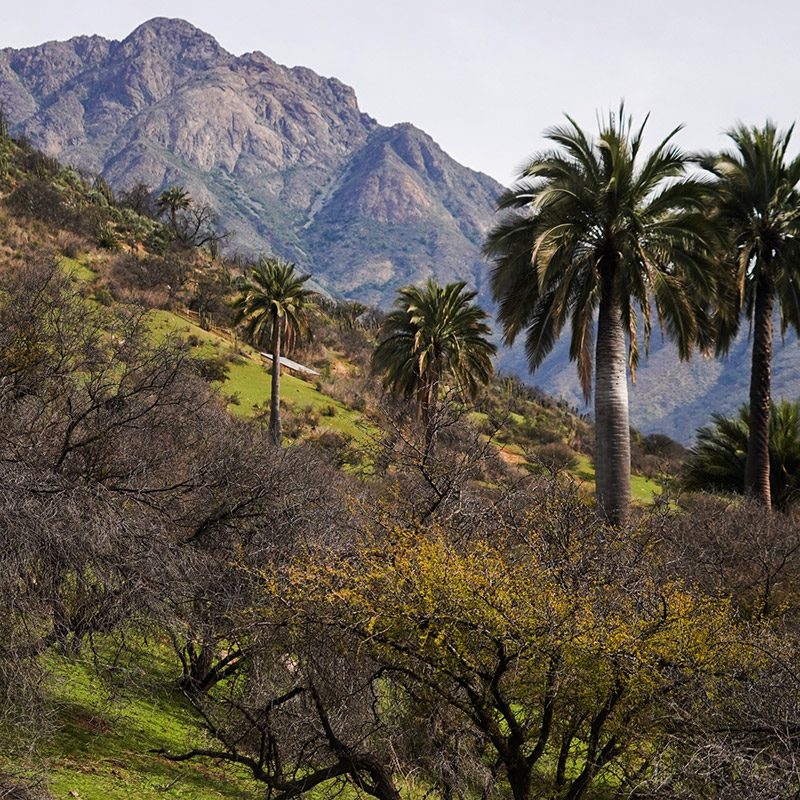
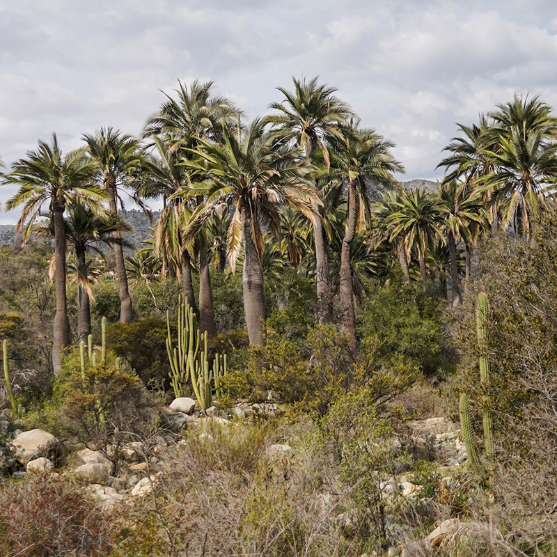
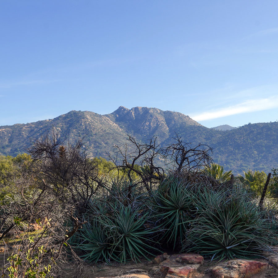
The creation of the National Park considered the protection of two species in particular, the Chilean palm (Jubaea chilensis), an endemic species of central Chile, in a vulnerable state, and the Santiago oak (Nothofagus macrocarpa), also endemic to Chile.

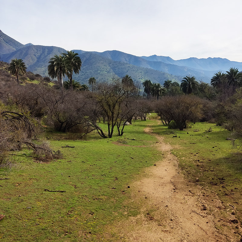
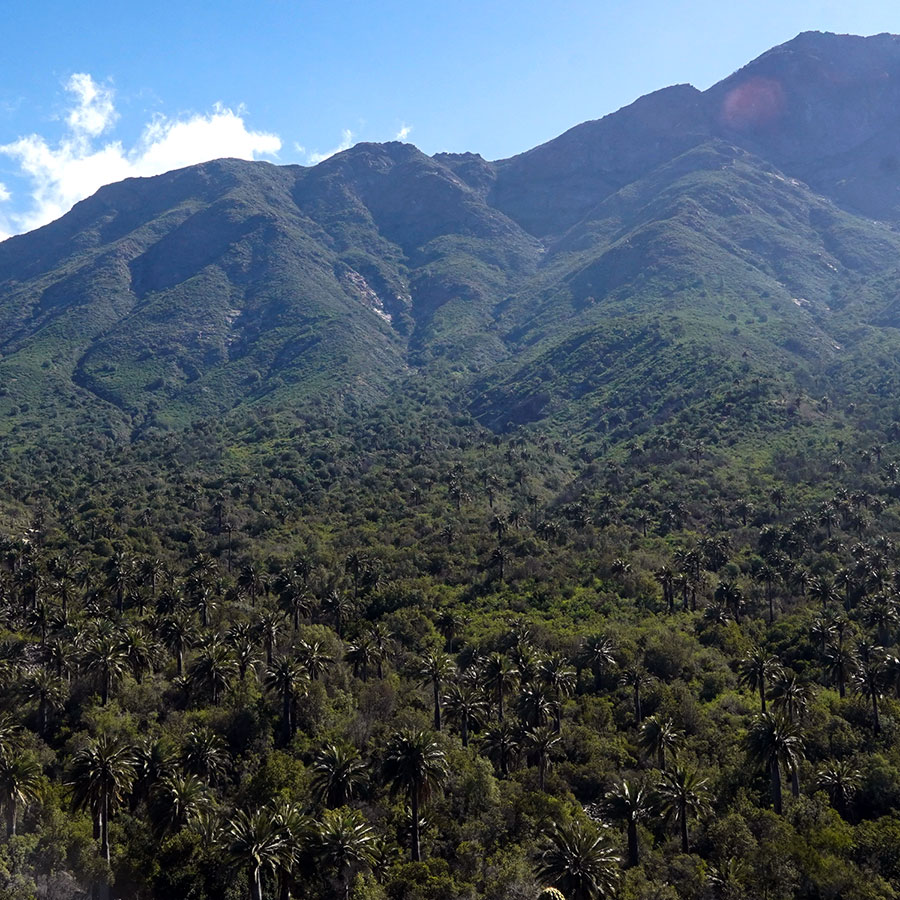
We are in the Ocoa sector looking towards the core area of the park, where the largest number of Chilean palms are concentrated. Behind the ridgeline are the sectors of Granizo and Cajón Grande where the oak forests lie and end. This is a sector of transition from a semi-arid to a Mediterranean climate, where the northern limit of the entire Chilean Nothofagacae family is traced.

An enthusiastic Francesco Di Castri referred to the National Park and the very particular characteristics of the National Park:

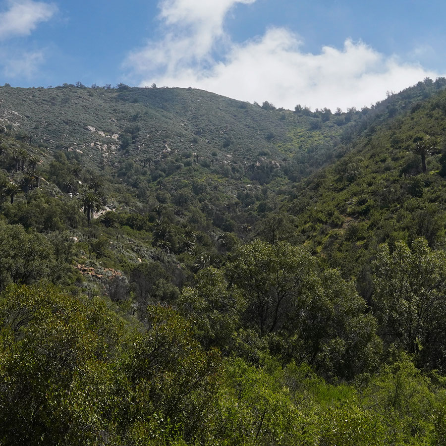
"It constitutes a true biogeographic and ecological recapitulation, in such a small space, of almost all the ecosystems found throughout Chile. Xerophytic scrub on the northern slopes, like those of the Norte Chico up to Paposo; oak (Nothofagus), canelo, peumo, boldo and palm forests in the ravines and southern slopes; small steppes on the summit of Cerro El Roble, similar to those of the Norte Grande and Patagonia. And what about the extreme richness of its biodiversity? Species of Paleo-Antarctic, Valdivian, Neotropical and Andean origin, all intermingled, until they constitute the most original biological mosaic".

Watershed - Divisoria de Aguas

El Quillay Circuit - Item N°1

The ridgelines we can observe correspond to watersheds between different hydrographic basins. The visible part corresponds to the Ocoa basin, which flows into the Aconcagua River.

And the invisible part? The line segment to your right that culminates at the summit of La Campana hill, separates the waters of El Bellotal de Rabuco ravine, which also flows into the Aconcagua. Behind the segment that continues to the left of this peak up to Punta Imán, it flows into the Limache stream, whose waters also feed the Aconcagua River just 8 km from its mouth in the Pacific Ocean.

Between Punta Imán and El Roble hill, we separate from the mini-basin of the Caleu stream, whose waters flow first into the Til Til stream and then successively into the Lampa and Colina streams, and from there into the Mapocho and Maipo rivers until culminating in the sea, on the border of the municipalities of San Antonio and Santo Domingo.

After the line that continues to the left of El Roble hill, its waters also flow into streams that are tributaries of the Aconcagua river.

Drag

Ecological succession

El Quillay Circuit - Item N°3

Changes in weather conditions and land use favor the colonization of new species and the extinction of others, which leave visible traces in time and space.

It is not uncommon that in long periods of drought, forest areas gradually give way to thorn scrub and xerophyte species, which, thanks to the modification of their leaves, stems and roots, are able to absorb and retain water for long periods of time in order to survive.

As you can see, nothing is static in nature. Ecosystems become more or less complex, depending on the diversity of living beings they contain and attract.

A Singular Rock

El Quillay Circuit - Item N°10

We can observe this rock covered by crustacean-shaped lichens. It settles on some of the rock’s faces and not on others, taking advantage of special conditions of exposure to the sun, as well as the roughness and porosity of its surface.

On the other hand, you will be able to notice how the rock is fragmenting, due to temperature variations between the minerals that make it up. On the surface, these are greater than those on the interior, resulting in the formation of thin sheets that progressively detach from it.

This process of weathering in rocks is known as thermoclasty.

Hillside Exposure

El Quillay Circuit - Item N°11

There are great differences in vegetation on either side of the creek. On the side opposite to us, sclerophyllous forest communities are predominant. On this side, we can find the thorn scrub.

The exposure of the hillsides regarding the movements of the sun can be sunny or shady. In our southern hemisphere, those facing north are more exposed to sunlight, heat and dryness, while those facing south, are shadier and colder.

The ravine bottoms, on the other hand, are shadier and more humid, allowing the formation of a more dense forest that is drawn linearly in its descent down the hillsides.

Collecting ravine

Waterfall Circuit - Item N°4

A collector ravine corresponds to a runoff that receives tributaries from an entire basin, allowing its drainage by means of a river. Depending on the time of year when you visit this spot, the creek may appear completely dry or manifest itself in the form of an estuary of crystalline waters due to rainfall. Either way, the mark that this collector creek has left on the landscape is undeniable. It is possible to observe the trace of the water, which has dragged rocks, deposited along its bed and then, over the years, modeled them with the rounded shapes that you can see.

But you are not the only person who has been absorbed by the beauty of the composition of this landscape. At the end of the 19th century, Onofre Jarpa, a Chilean landscape painter, captured his impression of the scenic beauty of the ravine in his beautiful painting called "Palmas de Ocoa", which is currently housed in the National Museum of Fine Arts. In this work you can see the portrait of the bed of rocks irrigated by the crystalline water, immersed in the wonderful vegetation and the palms that have been preserved to this day.

Drag

Landscape analysis

Waterfall Circuit - Item N°10

This viewpoint will allow you to observe the natural systems that make up the landscape composition of La Campana National Park. From here you can observe a panoramic view of the topographic features of the landscape and the way in which the processes of slope dynamics, such as gravity and rain, have softened the foothills. You can also observe how the mountain range in which you are located right now extends across the Ocoa Valley.

You can also appreciate the vegetation that covers almost the entire observable surface. You can notice some differences between what exists on one hillside and what exists on the other. In addition, you will notice that the darker colors of vegetation outline the more humid zones, allowing you to make out in the distance those sectors that correspond to ravines or streams.

Detrital flow

Waterfall Circuit - Item N°13

The landscape of La Campana National Park is in constant activity, since geomorphological processes are occurring everywhere and at all times. As you can see if you look towards El Roble hill, you can observe some material flows descending from the highest parts. The debris is the result of the disintegration of the rocks on the slopes of the hillsides due to factors such as rainfall, snow melt or temperature oscillation during the day. Debris flows are a process of removal and transport of this detached rocky material, due to gravity or rainfall. When the flow loses speed, it settles at the bottom of ravines, drawing these elongated spots at the top of the slopes. How many debris flows can you see from the point where you are now?

Sclerophyllous forest and coastal fog

Granizo - Ocoa Crossing - Item N°6

During the winters, thick morning mists that come from the sea and are driven by the winds, penetrate the Olmué valley, crash against the mountainous system of La Campana and El Roble hills and are used by the sclerophyllous forest to settle.

This same phenomenon is known further north as "camanchaca". It is formed by a layer of stratocumulus-type clouds that persistently cover a coastal strip that runs from Peru to central Chile.

The vegetation is favored by climatic compensation factors such as the influence of these coastal fogs, the low incidence of solar radiation and its location in the windward zone of the Coastal Mountain Range.

We are in the middle of the plant community of the sclerophyllous forest of peumo and boldo, with a strata of evergreen trees, poor in shrubs and a herbaceous strata with some ferns and an abundance of vines.

The Peumo (Cryptocarya alba), is an evergreen tree, endemic to Chile, which grows between the provinces of Limarí in the north to Cautín in the south. It flowers between November and December. You can recognize its yellow flowers or its fleshy, ellipsoid, white or pink fruit.

The Boldo (Peumus Boldus), also an evergreen tree endemic to Chile, grows between the bay of Tongoy and Osorno. It flowers from June to August. Its fleshy, yellowish-green fruit is sweet and aromatic. Its oval and rough leaves are used as an infusion to treat liver problems.

El Amasijo Ravine

Granizo - Ocoa Crossing - Item N°10

Pay attention to the ravine you see under your feet. It is called El Amasijo. Its waters supply the Rabuco stream, which is born when it joins the waters coming from the El Cuarzo ravine, to your right, and dies when it pours its waters into the Aconcagua River.

From the summits of this small basin, blocks of rocks have broken off, rolling down the slopes at different angles. Deposited there by some natural accident; then fragmented by the effects of water and temperature changes, until they gradually became maicillo and mixed with mud.

And it is in this special scenario where the largest population of Chilean palms, the southernmost palm species on the planet, endemic to central Chile, is located. It is a true survivor of the tropical forests that existed 30 million years ago in our territory, before the Andes Mountains were formed, which would act in the future as a barrier to species intrusions.

It also survived the subsequent overexploitation it suffered from colonial times until the end of the last century, as a result of the extraction of its sap and the manufacture of a sought-after honey. It is estimated that only 5 percent of its original populations exist today.

A 2017 study, aimed at quantifying the number of specimens in their different geographic distributions in the country, between La Serena in the north and Pencahue in the south, calculated a total population of 121,000 specimens. And almost two thirds of these individuals are concentrated here, in the small Ocoa Valley!

El Amasijo

Granizo - Ocoa Crossing - Item N°12

We are in the core area of La Campana National Park, in a zone where the main objective of protection that motivated the creation of the National Park is concentrated: the Chilean Palm.

Researchers from the University of Chile carried out studies of genetic diversity of the species in the different locations where the Chilean palm is found in the country, revealing that there is a high degree of inbreeding among them, which expresses endogamic traits that diminish their capacity to adapt and evolve in the face of environmental changes, leading to a greater risk of extinction.

Crosses are made between plants of the same population or "close relatives" and there is little survival of seedlings in a natural way. On the other hand, natural seed dispersal - another mechanism that promotes gene exchange - is carried out by small rodents such as the Degú (Octodon degus) and the Cururo (Spalacopus cyanus), animals that feed on these seeds and move them from one place to another, but they do so at distances of no more than six meters, unlike in the past, when this process was carried out by larger species, such as the extinct megafauna or the guanaco, which moved these fruits over greater distances.

The causes of this low genetic diversity include habitat fragmentation, the deterioration of the Mediterranean forest, human activities, the lack of animals that disperse their seeds over long distances and the deficit of natural regeneration.