La Campana National Park
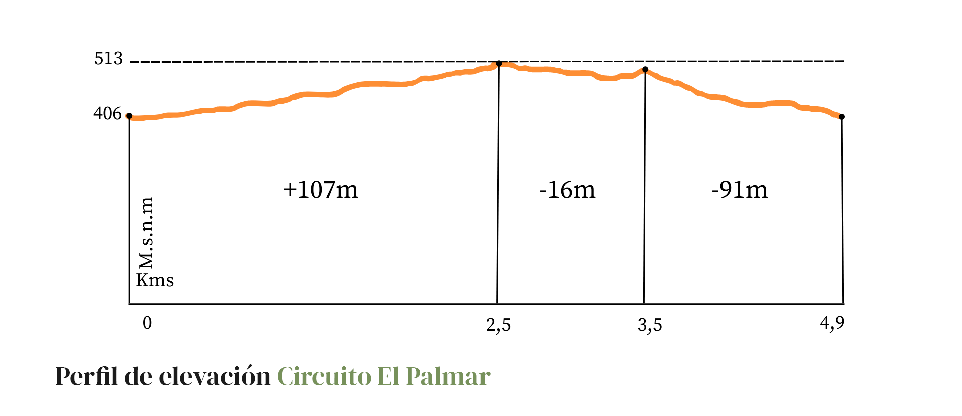
El Palmar Circuit
4.9km 2hr 27min107mt
Difficulty: Low
Low-difficulty hike, alternating between forest and sclerophyllous scrubland, crossing areas of fluvial sediments and low hills, in the foothills of La Campana hill.
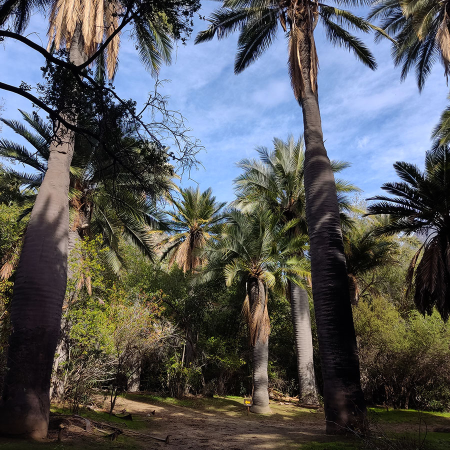
The Chilean palm is the main protagonist of this circuit that enhances the importance of having protected this place as a National Park in the 1960s, taking into account how this species was exploited since colonial times.
It is recommended to visit after the first rain of autumn until October, to avoid intense heat and exposure to the sun.
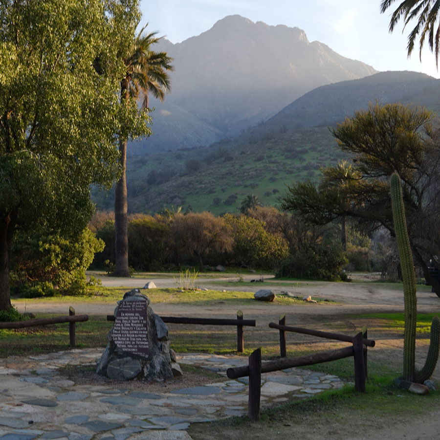
1. Commemorative Stone
In 1936, botanist Gualterio Looser proposed the conservation of the Ocoa palm grove to the authorities, the largest remaining around Valparaíso, and the rocky outcrops of La Campana hill, since they constitute the northern limit of this important family of Chilean trees, a vestige of a geological era with a more humid climate than the actual one.
In 1964, Agustín Garaventa and Álvaro Valenzuela initiated a strong campaign for the conservation of the area, getting Congressman Eduardo Ballesteros to present a bill to declare it a National Park. The park was formally created under Law No. 16,699, promulgated on October 17, 1967, but without a delimination of the area it would cover.
In October 1968, the owner of the Las Palmas de Ocoa estate, Raúl Ovalle, donated part of his land to the national treasury, with the objective that the State would take care of the existing vegetation on its hills, canyons and ravines, and protect the existing Chilean palms or those that would be born in the future. All this, under one condition: that the family could continue to make use of the palm grove for honey extraction and seed collection, which took place until 1982.
The donation was made in the political context of the Agrarian Reform. In the area, several neighboring estates had been expropriated and then subdivided, granting plots and hill rights to the former tenants. Thus, with the donation, the expropriation and delivery of plots to the tenants was avoided and the owner was able to continue exploiting his main resource for 15 years.
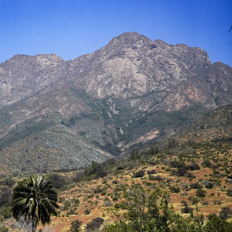
2. Cerro La Campana
"Mining activity in the Andes is millenary, perhaps as old as man on our continent. The extraction of salt and borates from the salt flats, the exploitation of clay banks for the manufacture of ceramic vessels, the extraction of volcanic glass and basalts for the manufacture of projectile points or other cutting tools, the collection of sediments of different shades for use as pigments, the location of quartz veins and semi precious rocks for the elaboration of ornaments, the outcrops of granitic rock with which they made hammers, mills or sculptures, the use of mud for bricks and plaster, and the list goes on with many varieties of elements of volcanic, metamorphic and sedimentary origin that were used for different purposes since immemorial times".
Christian Vitry, Mountaineer and Anthropologist
“The story goes back to the time of La Conquista (Conquest of Chile), when the Spaniards recently arrived in the Limache Valley heard from the local natives that in ancient times the cone of La Campana was a rock glittering with gold and gems, coveted by a foreign and courageous nation, that came to conquer it, but that the machis, or sorcerers of the place, resolved to outwit the greed of the strangers, arranging that in one night a thick layer of granite would fall on the enchanted hill, which would hide its coveted treasures forever”.
Drag
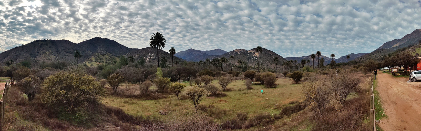
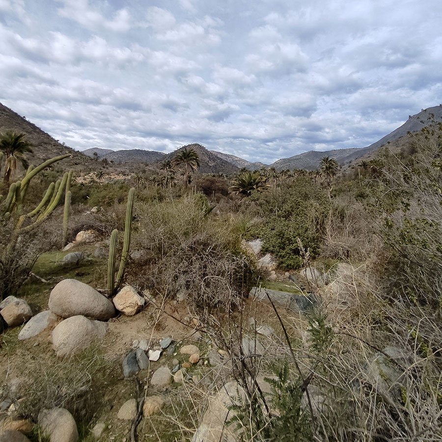
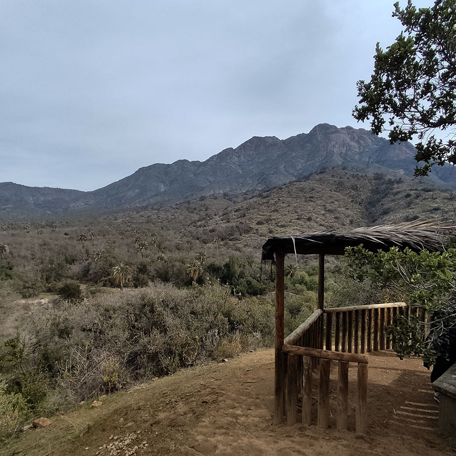
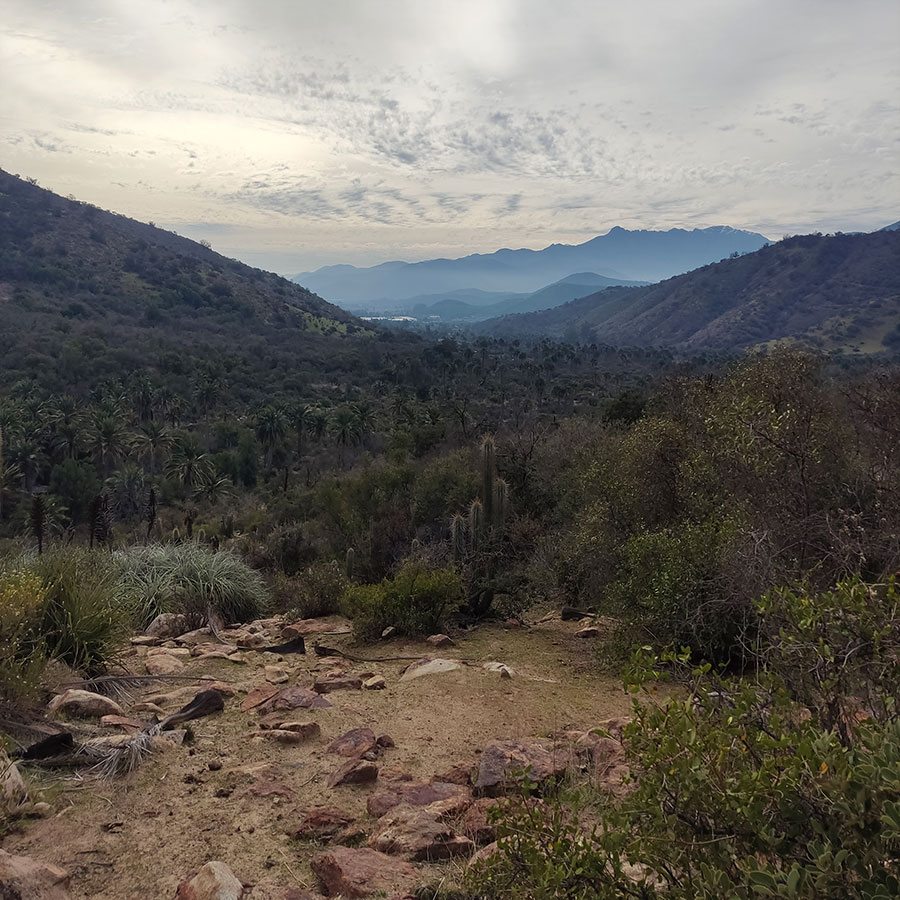
3. Mountain Ranges
Look at this landscape with a wide perspective. A panoramic view that almost completely covers the Ocoa sector of La Campana National Park.
To our right, the Cerro La Campana stands out, with its 1,828 meters above sea level. From there, following the line of peaks to the left, we descend until we reach a lower point. There is the portezuelo de Ocoa, where the trail that joins this sector of the park with those of Cajón Grande and Granizo passes.
Then the line ascends and is interrupted by El Labrado hill, which is on a closer plane, dividing the waters of the El Amasijo (right) and Cuarzo (left) streams. To its left, Punta Imán (right), 2,035 meters above sea level, and El Roble hill (left), 2,222 meters above sea level, mark the Park's border with the Caleu community and the Metropolitan Region.
And further to the left, the nearest line of hills, with El Litre hill at 1,621 meters above sea level, marks the closure of the National Park to the north, with its third collector ravine, La Buitrera, at the bottom.
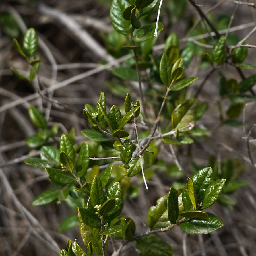
4. Sclerophyllous Forest
The sclerophyllous forest is a plant formation characteristic of Mediterranean climates where rainfall is concentrated in the winter months, while the summer months are usually very dry and warm. This type of forest is located between the Valparaíso region and the Biobío region, in the area commonly known as Central Chile.
The species of plants that predominate in this forest are prepared to resist drought and high summer temperatures because their leaves are very hard and thick. In addition, there is a predominance of perennial tree and shrub species, meaning that they remain green all year round. The tree coverage of this forest can reach up to 15 meters, in coexistence with smaller bushes and shrubs that shelter various species of mammals, reptiles, birds and insects. Among the elements that make up the forest you can find thorny species such as hawthorn (Vachellia caven) or Tevo (Trevoa trinervis); lauriphyllous species such as Belloto del Norte (Beilschmiedia miersii) or Peumo (Cryptocarya alba); and sclerophyllous species such as Litre (Lithraea caustica) or Quillay (Quillaja saponaria).
This type of forest is highly disturbed because it has been cut down for housing construction and agricultural activities, and has been affected by large-scale forest fires in recent decades.
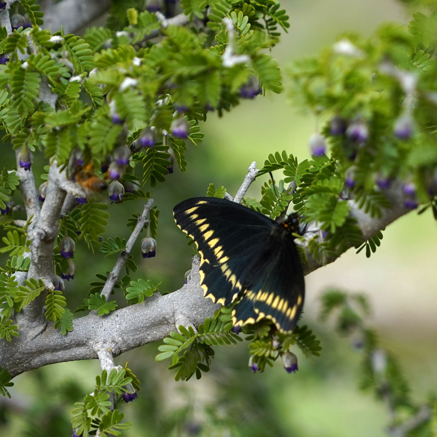
5. Guayacán
The Guayacán (Porlieria chilensis) is a tree that can be found from the IV region of Coquimbo to the VI region of O'higgins on coastal and rocky hillsides and even on plains. It is a tree with thick and crooked branches and evergreen leaves that remain green all year round, so it develops optimally in the company of other plant species of the sclerophyllous forest. It is a species that has adapted well to conditions of high sun exposure and nutrient-poor soils. Its flowering occurs during the spring months and its flowers are deep purple, which allows it to attract various types of pollinators. It can reach a maximum height of 6 meters and has very hard wood, which has been traditionally used to make tools for agriculture.
It is an endemic species, meaning that it can only be found naturally in Chile. It has been declared by the Ministry of Environment as a "Vulnerable" species due to excessive logging, overgrazing and habitat alteration.
It has been studied for its ability to move water from deep layers of the soil and raise it through its roots also increasing the amount of nutrients for plants growing nearby. This capacity called hydraulic lifting would make it a key species when thinking about strategies to face climate change and aridification in Central Chile.
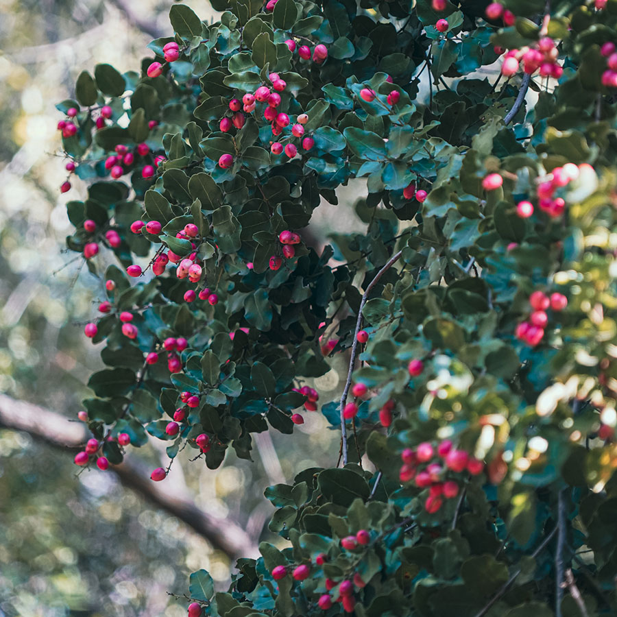
6. Hygrophilous Forest
A hygrophilous or hydrophilous forest is an evergreen plant formation, present in valley bottoms and river banks, i.e., in conditions of very humid soils that are temporarily flooded. These swamp forests develop in areas where the geomorphology benefits the accumulation of humidity, such as ravines. Among the causes of humidity are elements such as precipitation in the form of rain, groundwater upwelling and the influence of coastal fog.
Among the species that reach the highest altitudes in the upper canopy are the Belloto del Norte (Beilschmiedia miersii), the Peumo (Cryptocarya alba), the Naranjillo (Citronella mucronata), the Canelo (Drimys winteri), the Lingue (Persea Lingue) and the Patagua (Crinodendron patagua). In the lower forest layer there are various shrubs of the Myrtaceae family such as the Myrtle (Luma apiculata).
This type of forest is very particular because it represents a disruption compared to the vegetation that predominates in the rest of La Campana National Park, which is better adapted to cope with drought, and because it forms bioclimatic refuges that have allowed the conservation of various species of endemic flora and fauna.
7. Dam
This is the meeting point of the El Amasijo and La Cortadera ravines, where the Rabuco Stream, the main water collector for the Ocoa sector of the National Park, is formed.
The torrential valleys have lost their steepness, joining a flat area at the foot of the mountains, forming a cone-shaped alluvial deposit, which can be distinguished as an alluvial fan.
This type of relief morphology is easily modified by flood waters.
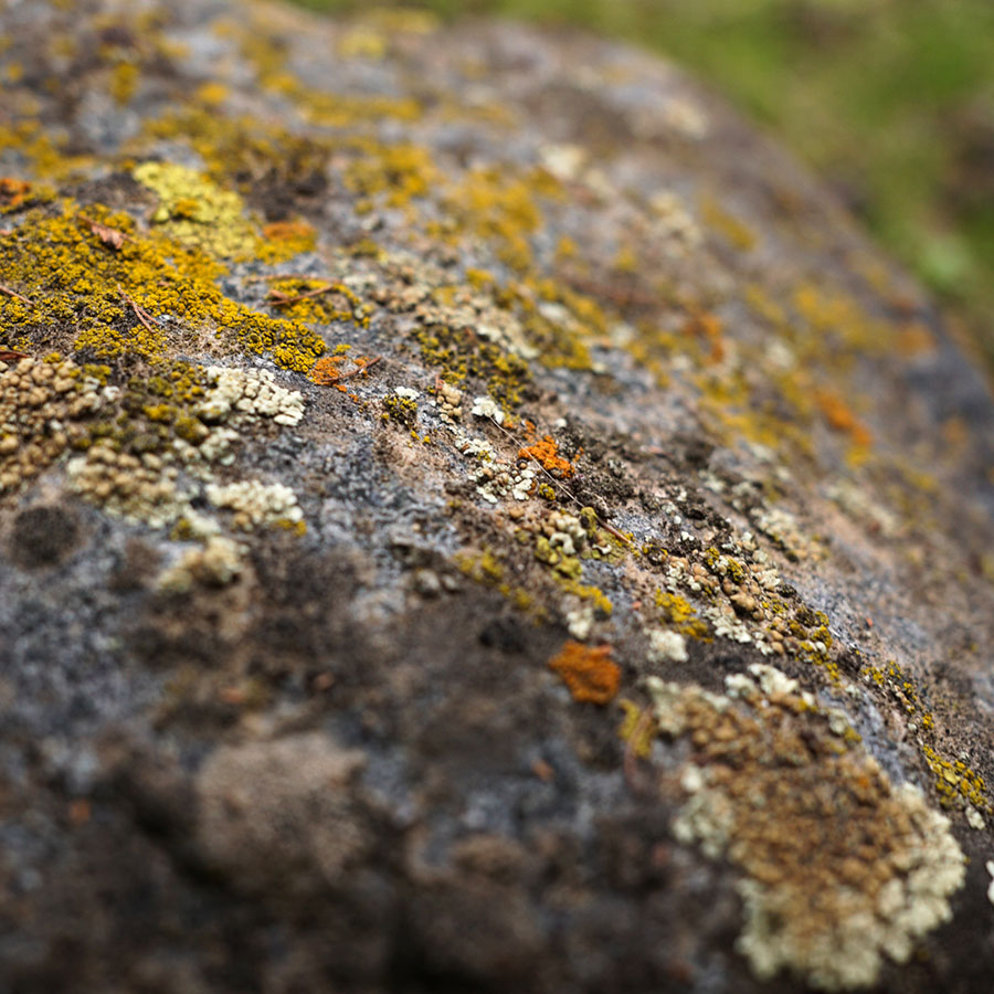
8. Lichens
The adaptability of lichens to adverse conditions, such as the dryness and intense solar radiation that characterize La Campana, is evidence of their ability to cope with extreme conditions. These lichens not only play a fundamental role in soil stability and moisture retention, but are also considered bioindicators of air quality, since their presence and diversity are intrinsically related to the purity of the environment. The conservation of this lichen community becomes a priority to preserve both the ecological integrity of the park and its scientific value by serving as a model of adaptation to adverse environmental conditions and contributing to the understanding of the complex interactions between these symbionts and their environment.
The profound diversity of lichens in La Campana National Park is not only of biological importance, but also adds an attractive aesthetic and scientific component to the region. Observing this diverse lichen community in such a harsh mountain environment underscores the importance of biodiversity and the imperative need to protect and conserve these ecosystems for the benefit of scientific research, and the sustainable enjoyment of future generations.
9. Casino
Palm honey is a product derived from the sap of the palm tree. To obtain it, the palm must be turned over. It produces up to 500 liters of sap in nine months, and is productive for up to two years.
Since the time of the Chilean Conquest, its production technique has been the same. The palm had a widespread presence in central Chile, but its exploitation intensified during the Republican Era, causing the depletion of the species.
An exception was Ocoa. In the 20th century, a rotation system was developed so as not to turn over all the palms in the same sector. About 300 palms were harvested per season. According to the former tenants of the estate, honey production was an exhaustive and strenuous job, but despite this, they remember aspects of the work with nostalgia.
The honey was sold by the estate owners. The work was entrusted to tenants. For many of the people who did it, the cutting of palms was reproachable, and they were glad that this activity was no longer practiced.
10. Soil Processes
Edaphology is the science dedicated to the study of soil properties and the processes of its formation, or edaphogenesis. It can be observed in three stages.
First, the parent rock is altered or weathered by factors such as temperature or precipitation.
Then, in second place, the first living beings such as mosses and plants are settled, which will further alter the rock material by influencing the chemical composition of the substrate, providing organic matter and nutrients through their biological processes.
Third, the components will mix through movements generated by the roots and by the flow of air or water through the pores of the substrate, forming a soil layer.
The mixture of diverse nutrients together with the humidity of the zone will allow the growth of diverse species of plants and mosses that will expand the forest surface.
11. Viewpoint to the Amasijo
La Campana National Park is located in the Coastal Mountain Range, immediately south of the Aconcagua River, whose transverse valley is the last of its kind, before the formation of the central valley and the intermediate depression to the south. It has a total surface area of 8,000 hectares and is divided into three sectors: Ocoa, with 5,440 hectares; Granizo, with 972 hectares; and Cajón Grande, with 1,588 hectares.
The creation of the National Park considered the protection of two species in particular, the Chilean palm (Jubaea chilensis), an endemic species of central Chile, in a vulnerable state, and the Santiago oak (Nothofagus macrocarpa), also endemic to Chile.
We are in the Ocoa sector looking towards the core area of the park, where the largest number of Chilean palms are concentrated. Behind the ridgeline are the sectors of Granizo and Cajón Grande where the oak forests lie and end. This is a sector of transition from a semi-arid to a Mediterranean climate, where the northern limit of the entire Chilean Nothofagacae family is traced.
An enthusiastic Francesco Di Castri referred to the National Park and the very particular characteristics of the National Park:
"It constitutes a true biogeographic and ecological recapitulation, in such a small space, of almost all the ecosystems found throughout Chile. Xerophytic scrub on the northern slopes, like those of the Norte Chico up to Paposo; oak (Nothofagus), canelo, peumo, boldo and palm forests in the ravines and southern slopes; small steppes on the summit of Cerro El Roble, similar to those of the Norte Grande and Patagonia. And what about the extreme richness of its biodiversity? Species of Paleo-Antarctic, Valdivian, Neotropical and Andean origin, all intermingled, until they constitute the most original biological mosaic".
12. Fluvial Plain
Around 1634 the owner of the lands in the Ocoa Valley was Francisco Pedraza, a powerful Chiloé encomendero. His property bordered Llay Llay to the northeast, Quillota to the west, Olmué to the south, and Caleu to the east. He had hemp plantations to make rigging and ropes to supply the army that battled on the Biobío frontier. It also had a vineyard, mill, tannery, cattle, oxen and mules.
At the beginning of the 18th century, the estancia was acquired by the Jesuits. Its main houses were located at the foot of Cerro La Calavera, and they cultivated a vineyard with more than 8,000 plants. They managed a considerable amount of livestock, including 1,791 sheep, 689 cattle and another 357 animals, including horses, mules and donkeys. They harvested between 600 and 800 bushels of coconuts per year, which were highly valued by the crews of the ships.
After the expulsion of the Jesuits in 1767, the property was leased and remained practically intact until 1822, when it was divided into five subdivisions: Ocoa, Vista Hermosa, Rabuco, Maitenes de Ocoa and Las Palmas. The latter became the Ocoa sector of La Campana National Park in 1965.
In the 19th century and the first half of the last century, the productive infrastructure implemented by the Jesuits was preserved, maintaining the raising of cattle, the exploitation of vineyards, the beneficiation of gold with mills and wash houses, the old hemp plantations to make rigging and the use of coconuts from the palms.
The productive situation changed strongly with the Agrarian Reform of the 60s and 70s, which led to the expropriation of estates and the subdivision of properties, tenants were given a plot of land in the plan, and in addition, a right to a hill. After the reform was reversed in the following years, many of these properties and rights of the tenants were acquired by outsiders, giving rise to a new population mosaic during the 21st century.
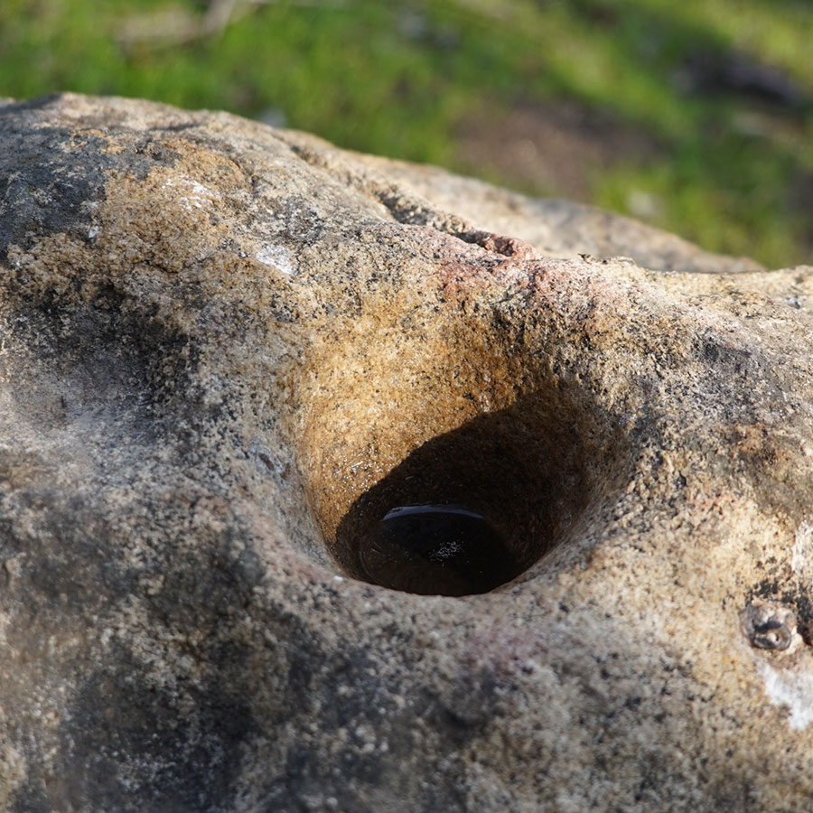
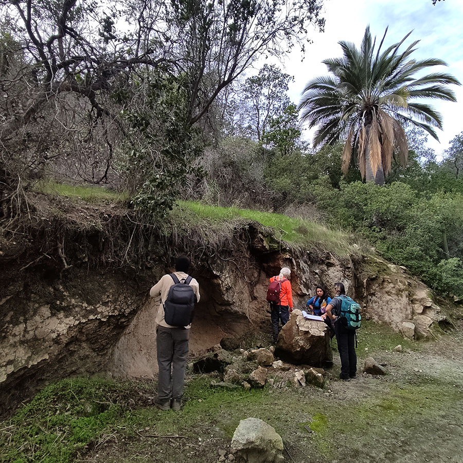
13. Cup Stone
Cup stones are large rocks with a hole in the center that were used by human groups in central Chile during the pre-Hispanic period. These rocks have various shapes, including circular, conical, ellipsoidal, or semicircular, and their functionality has been studied since the 19th century.
Sometimes multiple cup stones are found together, while other times they are found individually. In Chile, it has been determined that these structures were used for grinding or crushing materials such as seeds, minerals, animals, or plants. However, since the human groups who used these cup stones no longer exist, it is difficult to investigate other possible functions of these rocks.