Books

Echoes of the past

The history of La Campana National Park, in the Ocoa Region, is intertwined with the historical exploitation of the Chilean palm and the presence of the enigmatic "piedras tacitas" (small stones). During the 19th and early 20th centuries, the Chilean palm was intensively exploited in this region for the production of palm honey and aguardiente, which resulted in its drastic decline. In addition, the tacitas stones, mysterious petroglyphs dating back to pre-Columbian times, can be found in this area, adding an archeological element to the rich history of La Campana. This history of overexploitation of natural resources and the presence of these petroglyphs illustrates the importance of conserving the flora and cultural heritage in this area.

Commemorative Stone

El Palmar Circuit - Item N°1

In 1936, botanist Gualterio Looser proposed the conservation of the Ocoa palm grove to the authorities, the largest remaining around Valparaíso, and the rocky outcrops of La Campana hill, since they constitute the northern limit of this important family of Chilean trees, a vestige of a geological era with a more humid climate than the actual one.

In 1964, Agustín Garaventa and Álvaro Valenzuela initiated a strong campaign for the conservation of the area, getting Congressman Eduardo Ballesteros to present a bill to declare it a National Park. The park was formally created under Law No. 16,699, promulgated on October 17, 1967, but without a delimination of the area it would cover.

In October 1968, the owner of the Las Palmas de Ocoa estate, Raúl Ovalle, donated part of his land to the national treasury, with the objective that the State would take care of the existing vegetation on its hills, canyons and ravines, and protect the existing Chilean palms or those that would be born in the future. All this, under one condition: that the family could continue to make use of the palm grove for honey extraction and seed collection, which took place until 1982.

The donation was made in the political context of the Agrarian Reform. In the area, several neighboring estates had been expropriated and then subdivided, granting plots and hill rights to the former tenants. Thus, with the donation, the expropriation and delivery of plots to the tenants was avoided and the owner was able to continue exploiting his main resource for 15 years.

Casino

El Palmar Circuit - Item N°9

Palm honey is a product derived from the sap of the palm tree. To obtain it, the palm must be turned over. It produces up to 500 liters of sap in nine months, and is productive for up to two years.

Since the time of the Chilean Conquest, its production technique has been the same. The palm had a widespread presence in central Chile, but its exploitation intensified during the Republican Era, causing the depletion of the species.

An exception was Ocoa. In the 20th century, a rotation system was developed so as not to turn over all the palms in the same sector. About 300 palms were harvested per season. According to the former tenants of the estate, honey production was an exhaustive and strenuous job, but despite this, they remember aspects of the work with nostalgia.

The honey was sold by the estate owners. The work was entrusted to tenants. For many of the people who did it, the cutting of palms was reproachable, and they were glad that this activity was no longer practiced.

Cup Stone

El Palmar Circuit - Item N°13

Cup stones are large rocks with a hole in the center that were used by human groups in central Chile during the pre-Hispanic period. These rocks have various shapes, including circular, conical, ellipsoidal, or semicircular, and their functionality has been studied since the 19th century.

Sometimes multiple cup stones are found together, while other times they are found individually. In Chile, it has been determined that these structures were used for grinding or crushing materials such as seeds, minerals, animals, or plants. However, since the human groups who used these cup stones no longer exist, it is difficult to investigate other possible functions of these rocks.

La Buitrera Camping

El Quillay Circuit - Item N°4

La Buitrera is the name of this beautiful ravine and the nearby cliff areas, where large birds of prey such as the red-headed vulture, nest and take shelter.

This campsite was set up to welcome visitors to the National Park, combining shaded areas in the middle of this beautiful forest of sclerophyllous species and Chilean palms, with other sites without shade, designed for the coldest days or to enjoy the starry nights.

It unfortunately had to be closed years ago, due to the prolonged drought and the lack of water available to accommodate visitors, and today it is only used as a picnic area.

A trace of the recent history of the Park and a humanized evidence of the socio-ecological successions.

Clay Oven

El Quillay Circuit - Item N°12

Clay ovens are present in different sectors of the park, many of them are not visible since they are hidden by mud and plants that have grown over their debris. The ovens are a vestige of one of the main traditional economic activities of Central Chile: charcoal production. This activity dates back to colonial times and the process began with the extraction of firewood from sclerophyllous forest trees, preferably hawthorn, boldo, litre and peumo. The firewood was then introduced into the clay oven and burned in almost completely airtight conditions to make charcoal.

The ovens were built with layers of fresh clay arranged in a curved shape, a structure with small perforations all around it to allow the smoke to escape. The door used to be a piece of brass located at the bottom of the oven and was sealed with clay once the fire was lit.

Currently, because native tree species are subject to various threats, their use for charcoal production has been banned since their extraction and excessive logging have contributed to the loss of sclerophyllous forest area.

Cup Stone

El Quillay Circuit - Item N°14

The origin of these vestiges of human activity is not clear.

According to the Council of National Monuments "The cup stones are archaeological remains characteristic of the central zone of Chile, which would have been elaborated by hunter-gatherer peoples more than 10,000 years ago. Although they come in a variety of sizes and shapes, they are generally a flat, horizontal rock surface, in which shallow concavities have been carved in a circular or oblong shape. In general, they are located in spaces associated with ritual use, although it is estimated that they would have been used primarily for grinding seeds.”.

These early communities of the Llolleo cultural complex, hunters of fauna, but making vegetables a fundamental part of their diet, lived in small groups in ravines and valleys near water. They used their hands along with grinding stones and other drilled stones. They buried their dead around their houses and wrapped their children in clay urns, accompanied by objects.

Cup Stone

Waterfall Circuit - Item N°1

The cup stones found in the Aconcagua Valley in Chile are archaeological remains of human groups that lived in the region between 150 BC and 700 AD. These stones, known as cup stones, are often found near water sources and were likely used for grinding food or natural medicines. The fact that all the stones have similar holes suggests a cultural guideline on how to drill them. It is important to protect these stones from damage, such as graffiti or displacement, as they provide valuable insights into the ways of life of past inhabitants and help us understand the local culture.

Pirca

Waterfall Circuit - Item N°5

Until its creation, La Campana National Park was a place where diverse economic and traditional activities were carried out, many of them associated with the development of large-scale haciendas such as the Olmué Hacienda or the Mariana de Osorio Community, which originated in colonial times. The main activities that were carried out were related to agricultural production and livestock raising, whose vestiges can still be seen today, including dams, portezuelos and pircas. These structures have great cultural value because they are a historical record of the rural lifestyle in the sector. In addition, they have an emotional value for the generations of herders who have continued the development of these traditional activities. The pircas are low walls built by stacking unhewn rocks and have traditionally been used to divide properties.

Apacheta

Waterfall Circuit - Item N°11

What was the culture like in the first half of the millennium that ended in the year 2000?

They domesticated plants and camelids. Guanaco meat and bones were used as tools. Low valleys, suitable for the development of agriculture. Red and orange pottery. Cemeteries near the houses. Its domestic use is discussed as food milling or ritual, linked to ceremonies or water cults.

The Maray

Granizo - Ocoa Crossing - Item N°2

The Maray is an artisanal tool used for centuries since the Inca period for the fracturing and grinding of minerals.

The Incas worked gold washing sites in the Marga Marga valley and at the foot of La Campana hill. From the Qhapaq Ñan, the Andean road system that was the backbone of the political and economic power of the Tawantinsuyo, there was a branch that crossed the La Dormida slope, crossed this valley of the Limache estuary and went up to the top of the Marga Marga basin. Pedro de Valdivia himself, a few months after the beginning of the Spanish conquest, went into these valleys in search of the secret of its location revealed to him by Michimalonco.

Fernando Venegas recalls the words of Benjamín Vicuña Mackenna at the end of the 19th century, when he commented that "the La Campana hill, which gives it shade, horizon and fame, was then surrounded, according to travelers, by the vestiges of gold mills, whose ruins are today everywhere a mysterious statistic... and a comfortable seat for the weary traveler in its huntings and walks".

Mining

Granizo - Ocoa Crossing - Item N°7

Around 1830, a priest from the Santa Cruz de Limache parish discovered a copper vein in the La Campana hill. His discovery spread throughout the region and soon the hill was covered on all sides, Olmué and Ocoa.

In the middle of the century, mining began on an industrial scale and at the end of the 1920's the Compañía Minera e Industrial La Campana was formed, with 26 mining properties on the hill. This company went into crisis during the Second World War. It was reactivated at the beginning of the 1970s and it was not until 1994 that the last deposits in operation were closed.

The mining activity inherited the roads inside the National Park, which are currently used by park rangers and cyclists. However, it had a strong impact on the landscape. Accumulations of sterile material, forming mounds or cones in the vicinity of the deposits. The mining work modifies the profile of the slope, favoring the gravitational fall of rocky materials, dragged by finer sediments down the hillside during the rainy season.

Portezuelo

Granizo - Ocoa Crossing - Item N°9

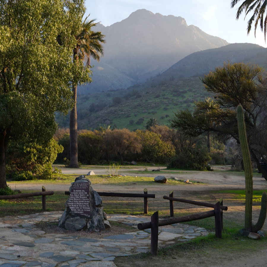
We reach the summit line, the Portezuelo de Ocoa, the highest point of the journey, with a multiplied panoramic view.

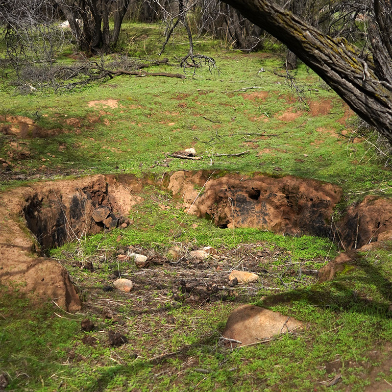
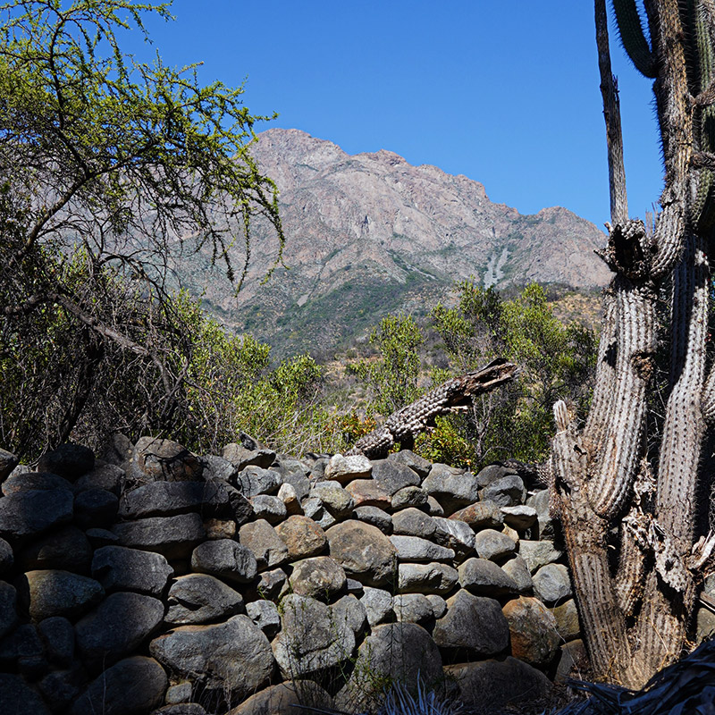
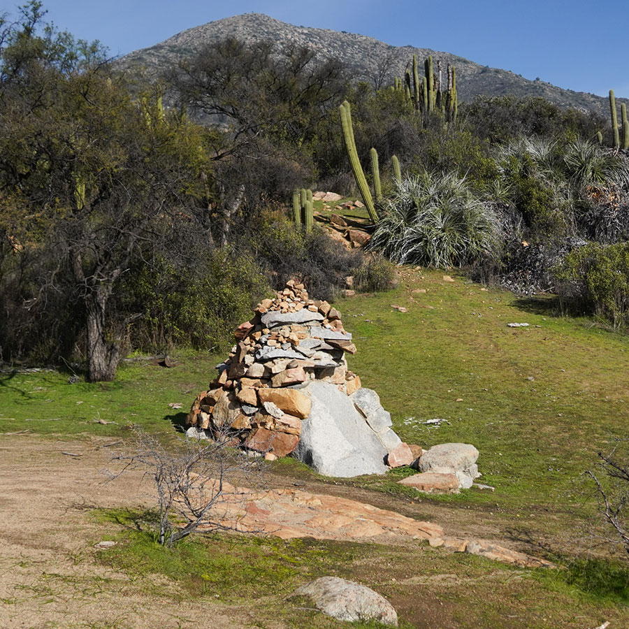
The watershed, delimited by a stone wall in the form of a pirca, which also separates two properties of very different history and characteristics. Towards Granizo de Olmué, it was the Indian heirs of the encomendera Mariana de Osorio in the 17th century who organized themselves as comuneros. Towards Ocoa, an hacienda that belonged to the Jesuits in the 18th century, was after their expulsion, administered as a large estate that was subdivided into 5 parts at the end of the 19th century, one of which is the current Ocoa sector of the National Park.

To the north, we can see the Aconcagua valley and the transversal mountain ranges that accompany its course. On clear days we can see 144 km away the snow-capped peaks of Mount Mercedario, located in the province of San Juan, Argentina, which reaches an altitude of 6,770 meters above sea level.

To the south, the valley of the Limache Stream, whose waters originate in the Dormida canyon, at the foot of the Vizcacha and Punta Imán hills, running almost parallel to the Aconcagua, finally pours its waters into the Aconcagua only 8 km from its mouth.

On a regional scale, we are at a transition point between a Mediterranean-type climate and a semi-arid one. On a local scale, we pass from a shady climate, with a majority of south-facing slopes, to a sunny climate, with noth exposed slopes. The coastal fog loses the influx that we have analyzed so far, when we enter Granizo.

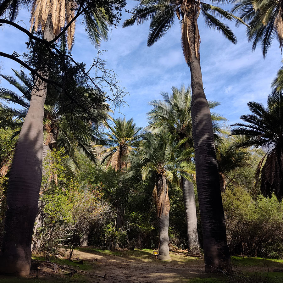
All these factors have important consequences on the diversity and distribution of the plant communities we are visiting. From the predominance of forest areas, we move on to areas with a predominance of sclerophyllous scrub.

Descending along the trail, the presence of the Chagualillo (Puya coerulea) stands out; a plant up to 2.5 meters high, elongated gray leaves, with a thorny margin gathered in inclined rosettes, which grows only in the coastal mountain range between 500 and 2,000 meters above sea level, between the regions of Coquimbo and Valparaiso.

It settles on granitic rocky substrates, facing steep hillsides, and then disappears below 1,000 meters above sea level.

Agua El sapo

Granizo - Ocoa Crossing - Item N°11

The watering holes are mandatory resting points for the herders who have historically brought their animals to these hills to graze, following old community traditions.

The country communities, formally called Agricultural Communities since the 60's of the last century, are a particular collective form of land tenure whose origin can be traced back to colonial times, since the sixteenth century, especially in hill areas of low agricultural productivity, which were not of interest to the conquerors.

"In their daily existence the comuneros continue to carry out transhumant cattle raising, even though they lose money. They continue with their landscapes of adoration, brotherhoods of Chinese dances, they light candles to the Virgin and make prayers to the saints and patron saints, so that it rains, so that they have water for the crops, so that there is pasture in the mountain ranges. They continue to recover their local history, recording their past of courage and resilience in the face of adversity".

In favor of the herders, it is thought that their animals have played an important role in colonizing the higher zones with palms, disseminating their coquitos through their feces.